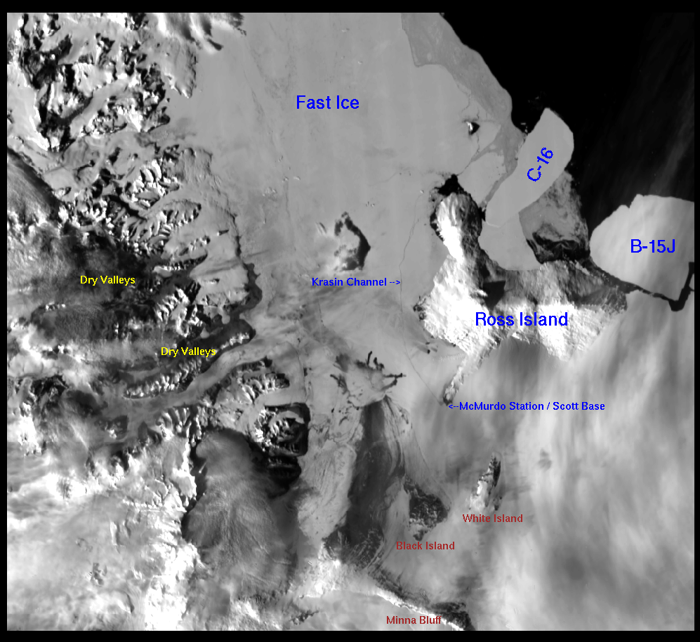
So I’m on the list that get’s the daily satellite images and I thought you might like to see where we are at and what the krasin’s channel looks like.
Rich
—–Original Message—–
From: mcm.terascan@usap.gov [mailto:mcm.terascan@usap.gov]
Sent: Saturday, January 21, 2006 8:36 AM
To: MCM-DL-TeraScan-DailyImages
Subject: 20 Jan 2006 Ross Island area sea ice & bergs
Hi All,
The clouds mostly left the area long enough to get this MODIS image.
Cheers,
Jeff